The 2022/2023 winter has been one for the record books. While most of Arizona is desert, good winter snowpack and spring storms allows us Arizonans to enjoy the age old quest for spring morels.
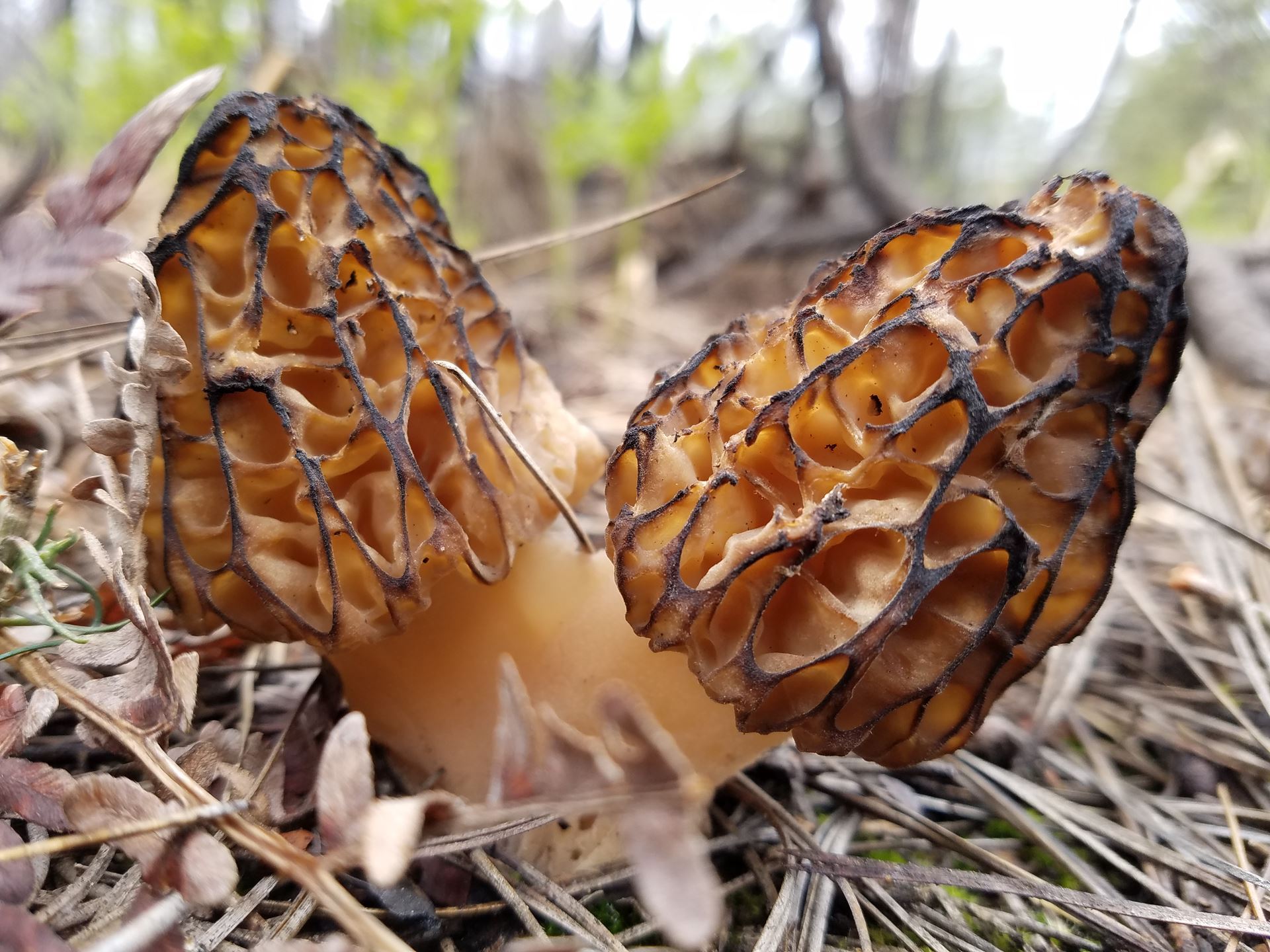
We get two types of morels in Arizona - those in the valleys and those in the mountains. Those in the valley grow in riparian areas (forests around streams) throughout Arizona where there are cottonwood trees in late March and April. Those in the mountains grow in recently burned areas from April through mid-June.
This year, due to the unbelievable winter precipitation, we have created additional maps and are once again providing all of these maps for free to AMS members.
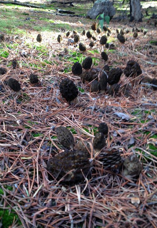
When conditions are right, burn morels can grow in large numbers in recently burned areas. They grow in habitat ranging from Ponderosa pine forests to higher elevation spruce-fir vegetation. Since they grow from tree roots, they can only be found in areas with these trees. The fruiting of morel mushrooms can be triggered by wildfires, so having a good map of recent wildfire boundaries is a key resource for having a successful hunt.
Those that grow in the lower elevations along streams with cottonwoods are much more rare and do not occur in burned areas. The "riparian morels" are often found earlier in the season and only for a few weeks. When they are found, there are rarely more than a few. Like the burn morels, finding and searching out their habitat is the best way to find them.
Hunting the Arizona morels is VERY challenging. You will need to consider key factors of the locations you are looking such as slope, aspect, soil temperatures, tree species, and whether or not the area has been recently burned. To help with the latter, the Arizona Mushroom Society has created maps of recent wildfires that can be downloaded and used by Arizona Mushroom Society members for FREE via the Avenza Maps app. In addition, due to the extreme winter precipitation this year, we have also created a map showing cottonwood-dominated riparian forest, so AMS members can search out and hunt the best habitat for those blonde river morels.
All AMS members have access to our complete library of existing wildfire perimeter maps available to you from 2018 through 2022 wildfires to help you find morels.
To access the free Arizona Mushroom Society Burn Morel library and for instructions on how to use these maps, please register for this event and an email with this information will be sent to you.